Storfjord - English outing cards
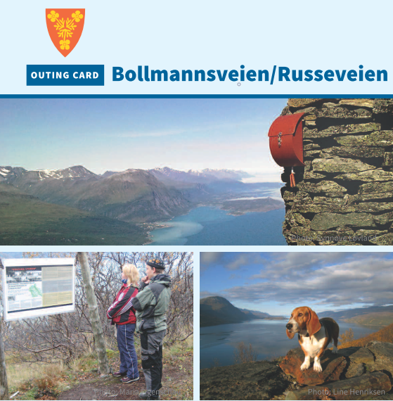
Bollmannsveien / Russeveien
The Bollmannsstien path is an exciting outing that winds up towards Falsnesfjellet mountain. The path is a war memorial, built by prisoners of war during World War II. Along the path are six information signs about the war years in Storfjord. At the top is a reconstructed bunker that can be used for a coffee stop or overnighting. The view over Lyngenfjorden is formidable and makes this a great trip even if you don’t reach the top. The trip is especially recommended when there is midnight sun.
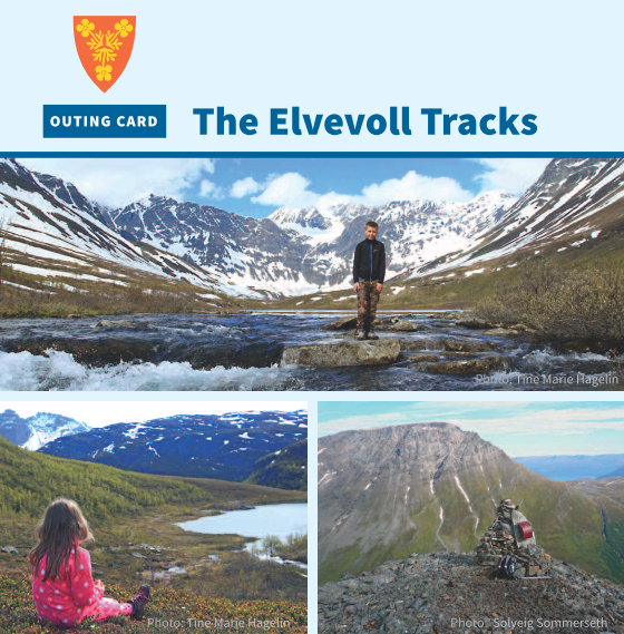
The Elvevoll Tracks
Starting at Elvevoll there are four outing options: Langdalen 3,5 km, Borri 8 km, Elvevolldalen 3 km, and Stálloborri 10,5 km. In the valleyscapes of Elvevolldalen and Langdalen it is easy to traverse to higher areas. By Skáidi, between the two valleys, there is a rest area with shelter. If you fancy a longer and steeper outing, take a loop by the cache at Borri (692 MASL). If you go all the way up to Stálloborri (1080 MASL) you will be rewarded with a fantastic view. All four destinations have a cache.

Lulledalen forest path
Lulledalen is located in the Lullefjellet nature reserve in the Skibotndalen valley and is one of Norway's least precipitated areas. The beautiful valley has a rich flora and fauna. On the path you can see the various habitats that are common here, and about 60 information posts about plants, wildlife, geology, and forestry. The area is rich in orchids, and is famous for the orchid marisko that should definitely be seen in flower. Coffee breaks are possible at path’s end with a fire pit and rustic shelter.
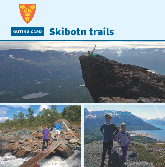
Skibotn Trails
Discover and explore Skibotn! Exciting gorges, a powerful waterfall and fantastic views are key attractions on this trip. Here you can reach four trim caches (Hengen, Sledo, Svarteberget and Várdovárri) and a top-trip cache (Ädjit). The tour is a loop along a marked path. The gorge and waterfall at Hengen alone are worth the trip. It’s also a unique experience when Olderelva forms a veil of water across the mountain side at Sledo during the flood season. The route to the top of Ädjit traverses terrain. Have a good trip!
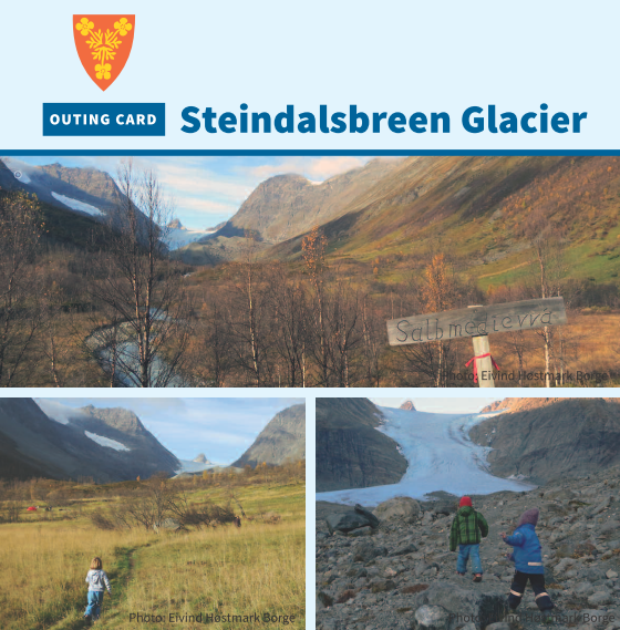
Steindalsbreen Glacier
Traversing beautiful nature surrounded by robust mountains, the path explores varied and exciting terrain suitable for most. The trip into Steindalen and onwards to Steindalsbreen glacier is a geological treat where you see ice-ridge steps covering a period of more than 8000 years. Information posts along the path explain the area’s flora, fauna and local place names. There are also signs depicting the glacier’s yearly withdrawal. Walking the glacier is discouraged for the unexperienced.
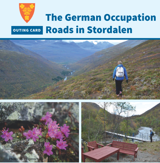
The German Occupation Roads in Stordalen
In Stordalen in the heart of Signaldalen you can experience the same roads and paths built during World War II by the German occupation. There are traces of the war, including bunkers. Well visible is Bunkershaugen. Here are several German bunkers. If lucky, you will see the rhododendron plant Lapprose with its purple flowers. Signaldalen community association has erected information signs that tell about activity in the area during the war. On the trip you get a fantastic view towards Sweden and Finland.
Siste nyheter
 Turkalenderen for årets 10 tilrettelagte turer er klar
Har du lyst på en ettermiddagstur eller søndagstur og oppleve nye friluftsområder i vår vakre region? Vi og våre samarbeidspartnere arrangerer 10 ture...
Les mer
Turkalenderen for årets 10 tilrettelagte turer er klar
Har du lyst på en ettermiddagstur eller søndagstur og oppleve nye friluftsområder i vår vakre region? Vi og våre samarbeidspartnere arrangerer 10 ture...
Les mer
 Friluftsskoler 2026- meld deg på sommerens kuleste eventyr!
Nå er påmeldingen til friluftsskolene i Lyngen, Karlsøy, Tromsø, Storfjord og Balsfjord kommuner åpne. Er du mellom (8)10-13 år? Har du lyst til å lær...
Les mer
Friluftsskoler 2026- meld deg på sommerens kuleste eventyr!
Nå er påmeldingen til friluftsskolene i Lyngen, Karlsøy, Tromsø, Storfjord og Balsfjord kommuner åpne. Er du mellom (8)10-13 år? Har du lyst til å lær...
Les mer
 Vi søker lærer i 50%-stilling!
Vi søker etter en prosjektmedarbeider med pedagogisk kompetanse og som brenner for uteskole og læring i friluft. Vi ser etter en person med stor frilu...
Les mer
Vi søker lærer i 50%-stilling!
Vi søker etter en prosjektmedarbeider med pedagogisk kompetanse og som brenner for uteskole og læring i friluft. Vi ser etter en person med stor frilu...
Les mer